#196432 - 08/24/1610:38 PMRe: Name this spot!
[Re: ndsol]
OregonMouse
member
Registered: 02/03/06
Posts: 6800
Loc: Gateway to Columbia Gorge
OK, it's Magic Mountain near Cascade Pass. Southern End of NCNP and near the Ptarmigan Traverse (which I've heard of but never done, not ever having been into climbing). I never have been to Cascade Pass, but I might try after seeing your photo!
Let's let someone else try, how about from the East or Midwest?
Edited by OregonMouse (08/24/1610:40 PM)
_________________________
May your trails be crooked, winding, lonesome, dangerous, leading to the most amazing view--E. Abbey
#196435 - 08/25/1612:20 AMRe: Name this spot!
[Re: OregonMouse]
ndsol
member
Registered: 04/16/02
Posts: 678
Loc: Houston, Texas
Originally Posted By OregonMouse
OK, it's Magic Mountain near Cascade Pass. Southern End of NCNP and near the Ptarmigan Traverse (which I've heard of but never done, not ever having been into climbing). I never have been to Cascade Pass, but I might try after seeing your photo!
Let's let someone else try, how about from the East or Midwest?
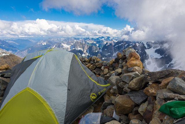
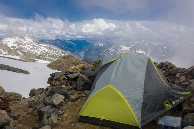
Yes, that is it, but you will have to get to Sahale Glacier Camp to see that view of (from left to right) Pelton Peak, Yawning Glacier and Magic Mountain.
A couple of photos from the tent site with one of the other sites in the second photo on top of another mound.
#196437 - 08/25/1603:07 PMRe: Name this spot!
[Re: ndsol]
OregonMouse
member
Registered: 02/03/06
Posts: 6800
Loc: Gateway to Columbia Gorge
I keep forgetting that now that my beloved dog has passed on, I no longer have to avoid national parks. It's the national parks' anti-dog policy that has kept me away from Cascade Pass all these years. I definitely have to improve my conditioning before I can make it up there--not sure if that's possible at 80, but I'll try!
Thanks for the photos!
JustWalking, I've never hiked in Idaho, but that lake shore is purty!
Edited by OregonMouse (08/25/1603:11 PM)
_________________________
May your trails be crooked, winding, lonesome, dangerous, leading to the most amazing view--E. Abbey
#196439 - 08/25/1605:03 PMRe: Name this spot!
[Re: OregonMouse]
ndsol
member
Registered: 04/16/02
Posts: 678
Loc: Houston, Texas
Today is the 100th Anniversary of the NPS. It is too bad that the NPS still doesn't allow dogs in the backcountry. Here in Texas, dogs are permitted in our State parks and I have seen no issues.
With a group of 13, it is difficult to make any national park work. North Cascades is one of the few whose system makes it somewhat feasible, but we had a backup plan as we didn't want to travel 2,000 miles and then not find what we wanted.
Even laying down some ground work (and working through many permutations), I still spent an hour at the Wilderness Permitting Center in discussions/negotiations for our permits, but in the end it worked out as we wanted.
#196453 - 08/30/1610:55 PMRe: Name this spot!
[Re: balzaccom]
ndsol
member
Registered: 04/16/02
Posts: 678
Loc: Houston, Texas
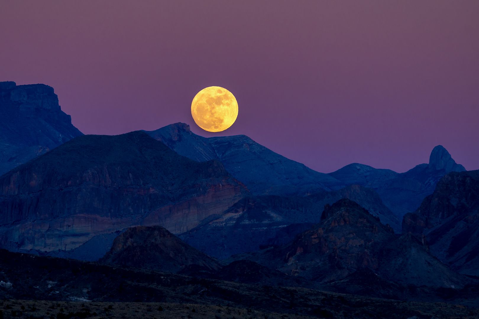
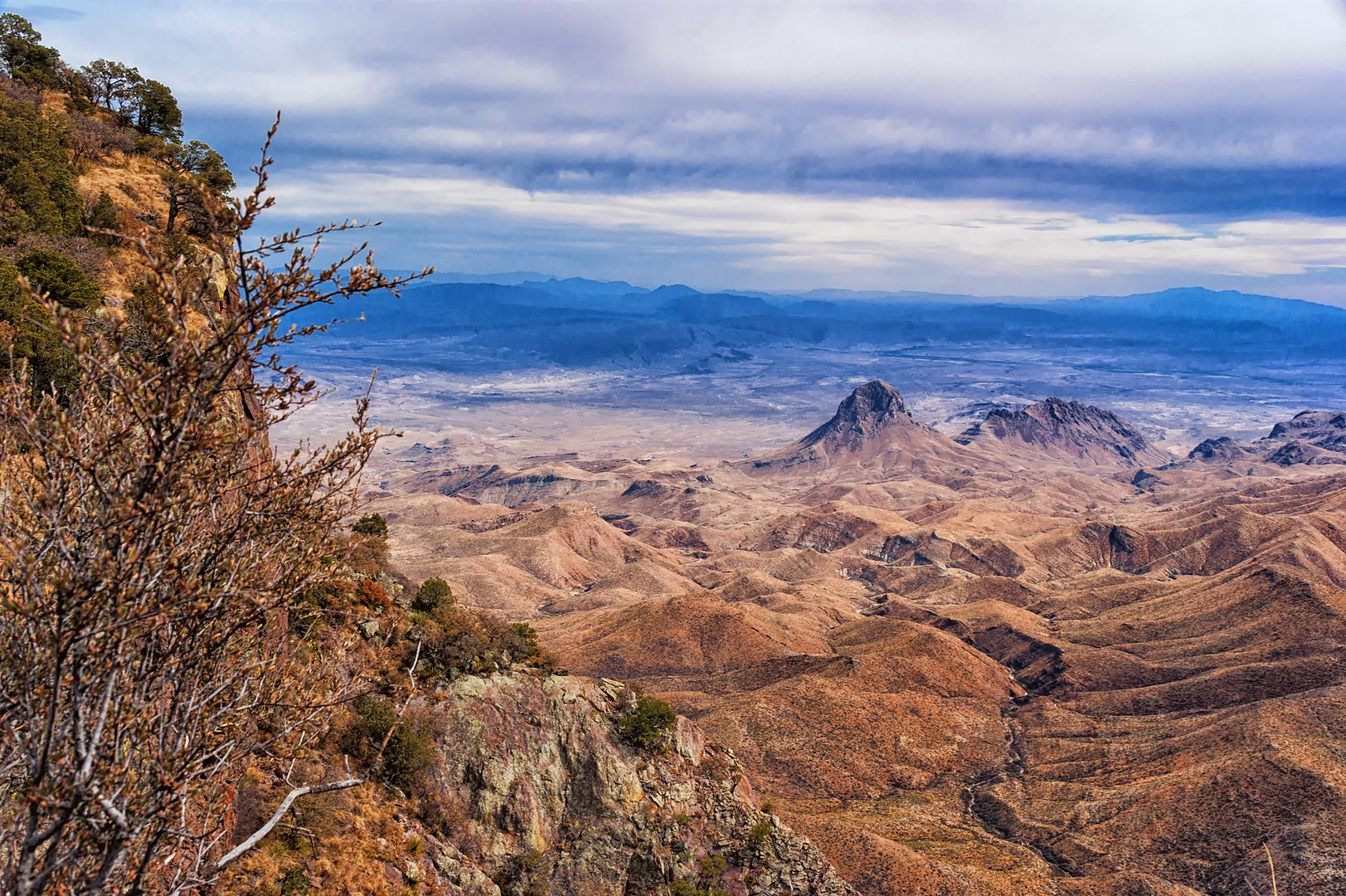
In honor of the 100th Anniversary of the NPS last Thursday, let's travel to one of our southern parks. This photo was taken last Christmas Eve. What I am interested in is not only the name of the park, but also the name of the prominent tall feature on the left, which is a backpacking destination:
#196456 - 08/31/1609:05 AMRe: Name this spot!
[Re: bluefish]
ndsol
member
Registered: 04/16/02
Posts: 678
Loc: Houston, Texas
Thanks. It is in Texas and one of its national parks, but not Guadalupe Mts. If you know how many national parks Texas has, then you will be able to know the park.
#196458 - 08/31/1611:32 AMRe: Name this spot!
[Re: balzaccom]
ndsol
member
Registered: 04/16/02
Posts: 678
Loc: Houston, Texas
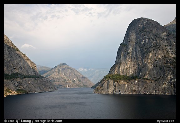
Yes, it is Big Bend and the mountain range is the Chisos (the only mountain range completed contained in a national park). Now I am looking for the feature on the left from which you can see Mexico.
This photo shows the view from that feature and the prominent feature on the right of the first photo is straight ahead in this one (extra credit if you can name it).
#196460 - 08/31/1607:01 PMRe: Name this spot!
[Re: balzaccom]
ndsol
member
Registered: 04/16/02
Posts: 678
Loc: Houston, Texas
Elephant Tusk for the extra credit! Not Punta de la Sierra on the left, but since you got the harder one, you should post next. What I was looking for was the South Rim.
Our long-time Sponsor, BackcountryGear.com - The leading source for ultralite/lightweight outdoor gear:
Affiliate Disclaimer: This forum is an affiliate of BackcountryGear.com, Amazon.com, R.E.I. and others. The product links herein are linked to their sites. If you follow these links to make a purchase, we may get a small commission. This is our only source of support for these forums. Thanks.!


 Previous Topic
 Index
Index


