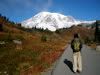
I just received my two draft copies of my guide to off-trail routes in the Wind River Mountains. It is exciting to see it as a bound book! I hope to have it out about late Oct or Nov. I am spending the summer in the WInd Rivers to check on lots of loose ends and get some better photos. The guide has 48 routes. I may bring it up to 50 just to say "50 routes in the WInd Rivers"! Most routes are about 50% off trail.
Because so much travel is off-trail, I include detailed route lines on topo maps. I decided to put all the maps on a CD rather than have an appendix. This saves almost 100 printed pages (the book without a map index is 300 pages) and everyone can just print out their own map set and not have to flip back and forth from text to maps in the back.
I have gone through a small printer-publisher and will have to buy a minimum of 50 books and peddle them myself. I just like the ability to talk to a real person and unlike Lulu internet publishing, I can add as many color pages as I want or need for a set price per page. Although I have to put up more money to purchase a quantity set, I also make a lot more money per book.
It has been quite an experience! I learned a lot and now have to learn more about selling books. I will have them on the internet and hope to get them in some stores too. I am not sure I want to do this again! This may be my last guidebook. It is a lot of work.
#117674 - 06/26/0903:16 PMRe: Progress on my Guidebook
[Re: jpanderson80]
OregonMouse
member
Registered: 02/03/06
Posts: 6800
Loc: Gateway to Columbia Gorge
Here's another person anxious to purchase the book! I'll bet you'll have a lot of customers from this site!
As you know, both the on-trail (Adkison, with no mention of off-trail hiking) and off-trail (Kelsey, far more emphasis on mountain-climbing than hiking) guidebooks to the Winds are 13 and 15 years old, respectively. That's very out-of-date for guidebooks. For that reason alone, yours is a must-needed addition!
Edited by OregonMouse (06/26/0903:23 PM)
_________________________
May your trails be crooked, winding, lonesome, dangerous, leading to the most amazing view--E. Abbey
Id be interested as well. We will be taking a road trip up from Texas to visit my brother in-law in Big Sky Montana next summer. We will be taking all our gear to camp and backpack with the family in the Yellow stone area. I'd like to check out the Wind river mountains while we are up there. Seen some amazing pictures of that area.
_________________________
My gear is no where near lightweight
"Author" is just a small part! The book has 70 maps and these have been more work than the words. Editing is the most consuming. Trying to deal with the computer stuff is the most frustrating. I guess I may soon learn that selling is the hardest! I am now in the final editing and PDF'ing phase. Hopefully off to the printer in a couple of weeks. He is a small volume printer so I expect it will sit on his desk for a while before it is actually printed. I also still have to work out the copyright and ISBN issues.
Registered: 02/05/03
Posts: 3293
Loc: Portland, OR
70 maps! Great Scott! This is truly a labor of love.
I'd love to see the approach you took to solving this thorny problem. Could you give us a preview by posting a jpeg of one of the maps? No rush, obviously. With you so busy now on the more important details of getting ready for publication, I don't expect you to honor this request anytime soon.
I should clearify - 71 pages of maps -- I basically divided each USGS 7.5-minute map into four maps with one page per quarter of a map. This is necessary if one is to have a chance of really being able to read a map on a 5.5 x 8.5 inch book page. I am sure my method is very tedious - but it works with the software I have.
1) scan my own USGS maps. I have a scanner that is perfect to scan each map quarter. This eliminates any copyright issues. I have a sign-off from USGS on this. I had to be careful not to scan at too high a resolution. I wanted each quarter map to a size that could be used in WORD as a "picture" rather than metafile.
2) Import each map to Excel. Use the drawing package in Excel to make route marks and label stuff. I used Excel simply because I am very familiar with it and for me, it works well. The only problem that I have yet to figure out is that a .jpg that is imported into Excel gets distorted - becomes wider.
3) Copy as "picture" into WORD. You have to highlight the "Cells" behind the maps to get the map and overlying drawing. Here is another problem - this creates a large file that loads slowly, so I did each map as a separate page. Now I fix the distortion by expanding the vertical size of the "image". This distorts the lettering in the drawing - just choose a font that will compensate.
4) PDF the WORD page into a 5.5 x 8.5 book page size. This is what goes to my printer. I had to use the "optomize for portability" font option so that the drawing lines are correct.
#123131 - 10/29/0910:31 PMRe: Progress on my Guidebook
[Re: wandering_daisy]
billstephenson Moderator
Registered: 02/07/07
Posts: 3917
Loc: Ozark Mountains in SW Missouri
That's so cool of you to take on such a big project. I've read myself to sleep and sweet dreams many nights with guidebooks and been shown the way to spectacular places I'd have never known about without them.
Will you be offering a downloadable PDF version of the entire book too?
I like books that I can hold in my hand, but printing only what I want is handy too. I always try and buy PDF repair manuals first if I need one.
I think a guidebook would be especially well suited for Web/PDF distribution. Being able to print maps and text for just the trails you wanted would be great and it gives buyers instant access when they're ready to purchase.
Plus, it offers a much less expensive way for you to distribute your book. Tons of people use my online software (ezInvoice.com) but I could never sell it so cheap if I had to box it up and ship it. You can't copy and steal my software because it's on the web server, and I suppose you'd have to consider that with a downloadable book. But I don't think you'd have much trouble with that.
Personally, I want the print version. They're better in bed
Our long-time Sponsor, BackcountryGear.com - The leading source for ultralite/lightweight outdoor gear:
Affiliate Disclaimer: This forum is an affiliate of BackcountryGear.com, Amazon.com, R.E.I. and others. The product links herein are linked to their sites. If you follow these links to make a purchase, we may get a small commission. This is our only source of support for these forums. Thanks.!


 Previous Topic
 Index
Index


