Ian, Heath and I were on a two-day backpacking trip in the Seven Devils in Idaho. We decided to hike the nearly 27-mile loop clockwise from Windy Saddle. We planned on stopping at Dog Lake to tank up on water since Ian felt that we might not see much water as we swung around the southern end of the loop and headed back north on the west side.
He was right.
Water was pretty much nonexistent for much of the west side of the loop. Unfortunately, we had missed the trail to Dog Lake, and didn’t realize our mistake until a few miles later. By then it was early afternoon and our water reserves were running low, but faced with the choice of going back to the lake or pushing forward, we chose to push forward. If this were a movie, I’d be inserting some foreboding music here...
The trip had started on an ominous note when we encountered heavy rains and lightning as we got near Riggins late in the afternoon on July 12. We were going to car camp at the trailhead and hit the trail the next morning, but the continual lightning strikes up in the hills, with a rather short flash-to-bang time, caused us to alter our plans and we headed for a local hotel instead. I mean, I like Christmas trees, but I don’t want to be one. Neither did my hiking mates.
The next morning was sunny and warm. We headed to a local coffee shop - which has its own roaster right there - and enjoyed some fresh-roasted coffee while scarfing down a delightful, fresh-baked cinnamon roll before heading up the mountain to the trailhead. Yum.
Our second treat of the morning was seeing a large cat (probably cougar) dart in front of the truck and off into the bushes as we climbed the dirt and rocky road toward Windy Saddle. It was turning out to be a good day.
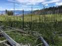
The Seven Devils (whose peaks have names such as He Devil, She Devil, Devils Throne, Tower of Babel, Mount Belial, The Goblin and The Ogre) is within the Hells Canyon Wilderness. The loop trail we followed put the ‘wild’ into this bit of wilderness. It is minimally maintained (if at all), chock full of blowdowns and tall overgrowth/thick undergrowth covering and obscuring the trail.
We were barely a mile into the trail when we encountered our first taste of what we’d trek throughout the two-day trip - crawling under or climbing over large blowdowns straddling the trail, pushing through thick brush, keeping an eye on the trail to ensure we didn’t stray from it. While it was slow going, it was early, so we kept our humor and ambled on. Besides, the magnificent views of surrounding peaks and valleys ensured we kept our cameras handy, so going slow was kind of a bonus.
There was also plenty of water on the east side of the loop, so water sources weren’t something we were paying attention to all that much. But when Ian decided we should check our position, with an uneasy feeling that we should have happened upon the Dog Lake trail by then, water availability was suddenly thrust to the forefront.
Still, it wasn’t all that late, maybe 4 p.m. or so, and it didn’t get dark until around 10 p.m., so we weren’t all that concerned. At around 6 p.m. we approached a snow field covering the trail, and doing so at a rather steep angle. Fortunately, it was large enough for us to melt snow and refill our bottles.
A bit over an hour later, now finished with the snow melting, we discussed how we’d get past the snowfield without going over the edge of the trail, which if we did would mean sliding/tumbling/falling down a steep, rocky bank for quite a ways - not the kind of Disney ride we had in mind. We decided we could maneuver our way over the bank and down its far side to the trail, which we did, one after the other.
As I had gone first, spurred on by Ian to yell “Leroy Jenkins” as I went, I walked around the corner while the other two made their way past the snow. “I hate to tell you this,” I started before trailing off.
“More snow?” came the replies.
“Oh yeah,” I responded.
And indeed, another snowfield, more treacherous than the first, blocked our path. It would be much more difficult to climb up and over this one. Fortuitously, I’d brought along my ice axe (makes the best potty trowel, don’t you know), so we set about digging a path across the snow on the narrow trail ledge.
By the time we got to the other side it was around 8 p.m., and we weren’t anywhere near where we could set up shelters for the night. Fortunately, we were pretty much heading downhill by this time, so we got our headlamps/flashlights out and kept them readily available. We would encounter a third snowfield a short bit later, but we easily negotiated around it and kept moving down the trail.
It was dark by the time we got to the trail for Baldy Lake. Ian was sure that further along the main trail we’d come to a nice creek and a flat spot for camping, so rather than detouring the mile-plus to Baldy Lake we continued our trek north.
And then we hit the overgrowth again. Staying on the trail was made much more difficult by the darkness - luckily Heath seemed to have a nose for the trail and kept finding it through the thick growth. Good thing, as we were still high enough in some spots for a wrong step to send us over the side of the trail and down among brambles and rocks. We finally found the creek around 11 p.m. and stopped for the night.
In a somewhat fitting end to the evening, Ian’s headlamp died just as he was tying off his Ursack. He finished by the light of my flashlight, which died seconds after getting back to the tent, just before we got into our bags.
I tend to get a bit barn sour when nearing the end of a hike. It has little to do with how the hike went, who I’m hiking with, the weather, or any of the other myriad parts of a backpacking trip. Quite simply, when I’m near the end, I’m ready to be at the end.
Still, the long, steep climb a couple of miles from the end probably contributed a small bit to this feeling. Fortunately, the views were still incredible. Unfortunately, we still had a section full of blowdowns to negotiate before our final climb.
As we arrived back at the truck and began cleaning up a bit before the long drive back to Ian’s, we mused about a return trip to this area with some pruning shears and saws - giving a little back to this trail we had come to deeply appreciate.
I wonder what the water situation is like in the fall.
Well, your post on the “fill out your profile” page shamed me into re-reading this. (I usually glance through all the trip reports, and tend to really read the eastern US reports more thoroughly, since that’s where I hike.)
This is a really nice report, since it talks as much about your and your companions’ reactions and feelings as it does about the trail itself.
I do have a question about the picture of the snowfield. Being from the east, I’m having a little trouble with perspective. If that were on an eastern trail, it looks like the picture would have been taken from about 100’ away from the snow, and it would only be 100’ or so long, maybe 6 or 8 inches deep, and those would be 15-20 foot trees on top of the rock wall.
What I’m wondering is what the real dimensions are. Based on your description, I suspect that’s not just a quick stroll with the snow squashed flat where you step? With trees being taller in the west, I’m thinking that might be a far more substantial and difficult snowfield than I’m used to seeing around Ohio and Kentucky?
Ha! I wasn't trying to guilt anyone into responding to this, honest! Was just making an observation.
I don't really remember the dimensions, but I took the pic with my iPhone from a few feet away. The snow field was probably only about 30-40 feet long, not bad, really, at all. The difficulty was that it was steeper than it seems from the pic, and if you slid off it, which seemed like it could have been easy to do, you were going to slide down for quite a long way with nothing to slow you down except big rocks at the bottom. And we weren't wearing traction devices.
The snow was probably a foot and a half deep at the deepest edge. Two of us weren't all that concerned, to be honest, and would have just crossed it slowly, kicking in steps. But the other member of our party wasn't going to cross it until we dug it down to make it easier. To be fair to him, he wasn't used to hiking on snow at all.
Now I see - a closer look does reveal how steep the downhill side of the trail is. Also, I clearly misjudged the depth (again, the eastern filter: I rarely see snow more than a few inches deep; any deeper, and we can’t drive to the trailhead. )
OregonMouse
member
Registered: 02/03/06
Posts: 6800
Loc: Gateway to Columbia Gorge
After being on this forum 12 years and being a moderator for about 5 of those years, I just discovered that there is a trip report section here in Photography.
I generally read and comment on the reports in the Trip Plans, Reports and Inquiries section. But I never knew this place existed. Probably because I've never figured out how to post photos here without using a third-party site, which I no longer use since they're not free anymore.
That probably explains why the few trip reports in this section get ignored!
_________________________
May your trails be crooked, winding, lonesome, dangerous, leading to the most amazing view--E. Abbey
OregonMouse
member
Registered: 02/03/06
Posts: 6800
Loc: Gateway to Columbia Gorge
I just took the time to read and admire the photos of your trip report and the others here. Sorry for the delay (my bad!).
An excellent report with a few reminders about water supplies and extra batteries for the rest of us to ponder!
I hope that more folks will be led to use this section of the forum so it gets more traffic! And that those with more computer knowledge than myself (which is probably nearly all users of this forum) will be able to upload their photos!
_________________________
May your trails be crooked, winding, lonesome, dangerous, leading to the most amazing view--E. Abbey
Our long-time Sponsor, BackcountryGear.com - The leading source for ultralite/lightweight outdoor gear:
Affiliate Disclaimer: This forum is an affiliate of BackcountryGear.com, Amazon.com, R.E.I. and others. The product links herein are linked to their sites. If you follow these links to make a purchase, we may get a small commission. This is our only source of support for these forums. Thanks.!


 Previous Image
 Index
Index


