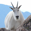
This is one of the best beginner's backpacks I know. It also leads to the exploration of some neat mines and access to climbing , fishing, and some less traveled passes.
No! We're back in the Sierra. This spot sees a lot of traffic for very good reason, but, off-season it is spectacular. Hint: It's one of the highest trailheads.
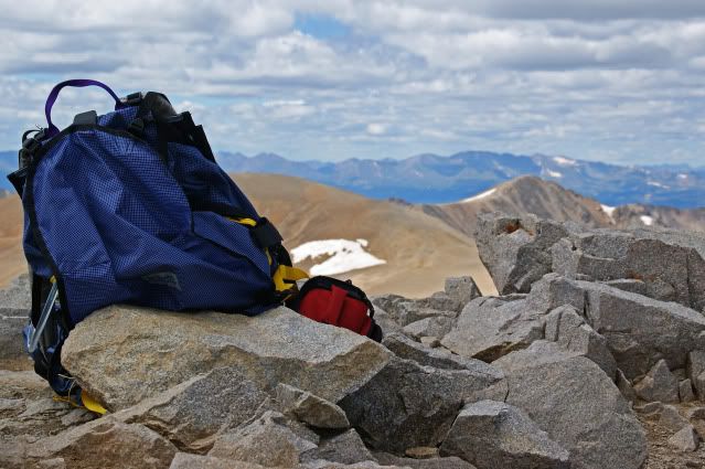
Rick, my pic was taken about 2 1/2 miles east, and a little lower in elevation. You have to go a little up a pass and west to drop into the Treasures. I was looking for the name of the valley, not the peaks or lake. Keep going up the scree and over the ridge from where that pic was taken and you drop into one of my favorite fishing spots. Obviously you know the name of the valley and the trailhead, I'll give you Heart Lake. Tell the folks where we are and take the reins. My next trip to the Sierra will be out of there and up Pine Creek to Granite Park.
Boy, I feel like a lowly scavenger, picking away at the carcass after others have done all the work.Are we talking about Little Lakes Valley, Mosquito Flat trailhead? Actually, I've used that trailhead for Mono Pass: it's nice using a 10,400' trailhead to get a headstart on a 12000' pass I love Granite Park: are you getting there via the pass at the head of Little Lakes (never been there), or via Second Recess (have been there) and down to Lake Italy?. I gather you could do a loop via those to routes, but I've only been to Granite Park from Pine Creek Trailhead (definitely NOT one of the higher trailheads around!) I will also add that I have a tremendous fondness for the Second Mono Recess: spent some delightful days of solitude there, just me and my dog.
Bobito, I lived at the bottom of Sherwin Grade at one time, so LLV was my back yard, so to speak. I love it dearly, as does my wife; we'll go in over Morgan Pass and cross over past the tungsten mines. Glad you've been there, and you hit the nail on the head with the headstart that trailhead provides. Now, lets head out with Rick.... Edit: Though Rick didn't name the specific vague place I took the pic from, he did get that it was Morgan, Bear Creek Spire, Julius Ceasar, Abbot and Gabb. Plenty close enough. Bobito will get a turn, without a doubt.
#195494 - 05/26/1605:49 PMRe: Name this spot!
[Re: Rick_D]
OregonMouse
member
Registered: 02/03/06
Posts: 6800
Loc: Gateway to Columbia Gorge
Love the picture, but if, as I suspect, it's in California, I haven't a clue. I've never backpacked in the Sierra. It might be Wyoming's Wind Rivers (very similar mountains) but, if so, not a place with which I'm famliar.
Can we have some Pacific NW shots? Then at least I can feel bad if I don't recognize them!
_________________________
May your trails be crooked, winding, lonesome, dangerous, leading to the most amazing view--E. Abbey
OregonMouse
member
Registered: 02/03/06
Posts: 6800
Loc: Gateway to Columbia Gorge
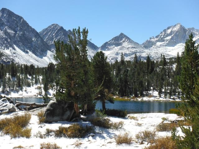
W_D, I sure don't recognize it with all the snow and cloud! Might be Mt. Baring? Certainly has the look of the North Cascades, peaky granite stuff, quite different from our volcanic peaks in Oregon and southern Washington! Awesome picture!
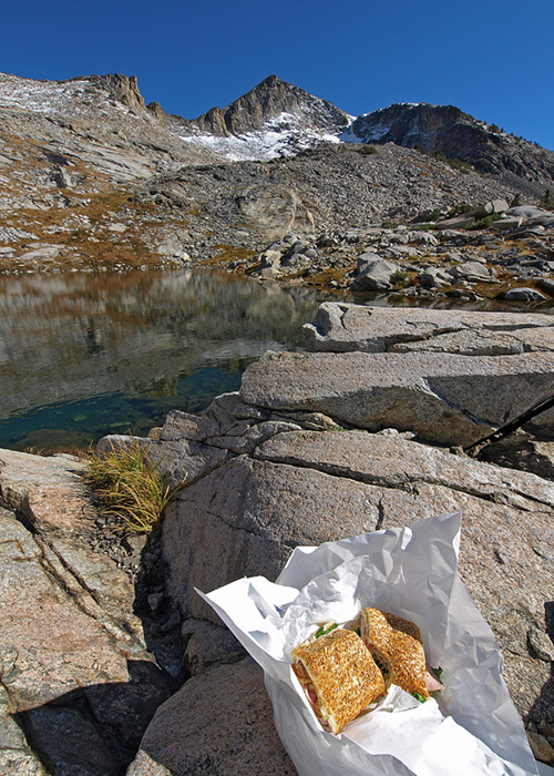
Back to Rick's peak--I haven't a clue, but is the sandwich toasted ham and cheese?
Edited by OregonMouse (05/26/1611:59 PM)
_________________________
May your trails be crooked, winding, lonesome, dangerous, leading to the most amazing view--E. Abbey
It is Early Winters Spires along the North Cascade Highway, BEFORE the road was finished! I was at UW in Seattle (1968-9) and we decided to ski up the unfinished road bed in the winter. I had climbed Early Winter Spires a few years previous, with a long approach, well before the road was built. It was amazing to us that this rock, that was so hard to reach, now would be so accessible. As rock climbers we liked this; but still mourned the loss of "wilderness".
For the sake of a bit more fairness, since this forum includes areas throughout the country, if you identify the photo then try to put up a photo of a different area/mountain range/state. Otherwise, I can see this devolving into an ever narrowing puzzle only solvable for those who happen to backpack in a single range.
well, I'll take my chance on being a dummy: How about Mt Ritter, though not an angle I'm familiar with, and Banner not looking very Banner-like...in other words, why the heck did I guess that?
A bold guess but this peak isn't quite in Ritter's league, lacking the vertical reach, although it's still the tallest of its group. Travel north to vistas of North America's noblest alpine lake to find our entrant. Strawman only wanted a brain and our destination pines (heh) only for a scant sixteen feet.
well, it does look like a Pyramid, so that eliminates Isoceles Peak, Half Dome, and Square Butte...How about Pyramid Peak, the one in Desolation Wilderness? I've even camped in eyesight of it, though I don't have it committed to memory
Our long-time Sponsor, BackcountryGear.com - The leading source for ultralite/lightweight outdoor gear:
Affiliate Disclaimer: This forum is an affiliate of BackcountryGear.com, Amazon.com, R.E.I. and others. The product links herein are linked to their sites. If you follow these links to make a purchase, we may get a small commission. This is our only source of support for these forums. Thanks.!


 Previous Topic
 Index
Index


