Tour of High Sierra Lakes
August 4-13, 2008
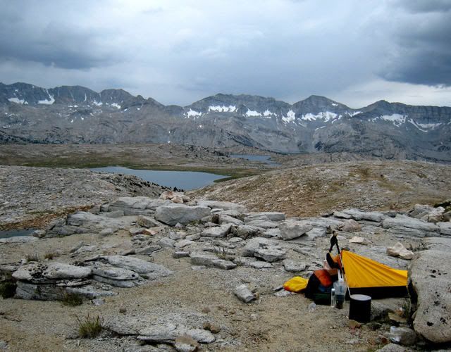
Day 1: North Lake to Puppet Pass. Although the quick 7-mile walk on the trail from North Lake to Desolation Lake was full of people, it was beautiful as I passed a handful of lakes on the Piute Pass trail! I then began the slow off-trail wandering, past Mesa Lake, spending my usual hour trying to find the most scenic campsite. I ended up about a mile further, next to a tiny trickle of water near Puppet Pass where I spent the late afternoon listening to light drizzle on my small tarp over my bivy. The view was fantastic. I could see a small colored dot at Mesa Lake- someone else camping.
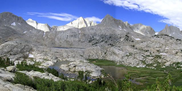
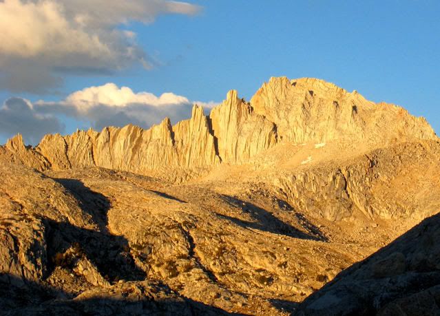
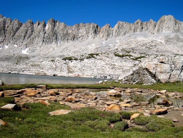
Day 2: It was still drizzling when I awoke at dawn. I packed up anyway and luckily it cleared by 7AM, because the descent of Puppet Pass is no place for wet rock! The bench below contains 16 named lakes and many more small ponds, all above timber and pure deep blue.
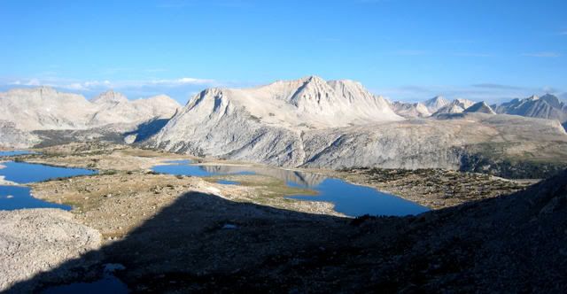
View from Puppet Pass
Off trail travel here is delightful. A bit worried about the deteriorating weather, I skipped visits to Steelhead and French Lakes and directly hike to Pine Creek Pass.
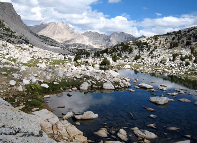
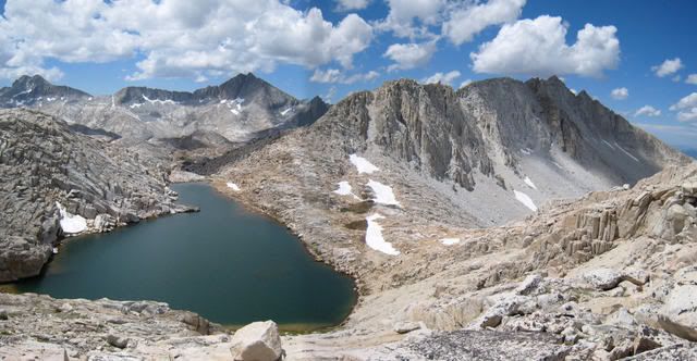
Pine Creek Pass
After a short break I headed up the hill to the five Royce Lakes, again to spend the afternoon in light rain. The only person I saw today was a fellow I met at North Lake who was a real ultra-light packer on a 6-day loop with the same route as mine for the first 5 days. What a coincidence! He started with 18 pounds; me with 28, so I did not expect to see him. Day 2 was an 8-mile day with 5 hours of travel.
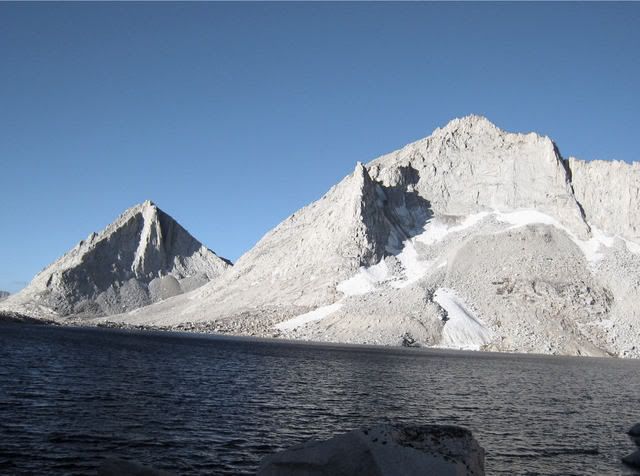
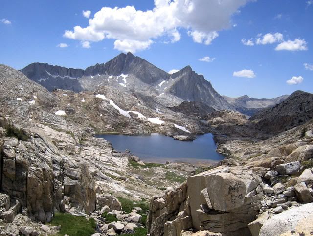
Royce Lakes
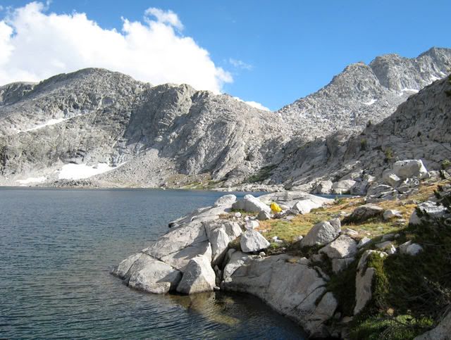
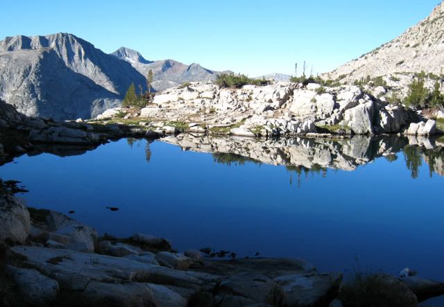
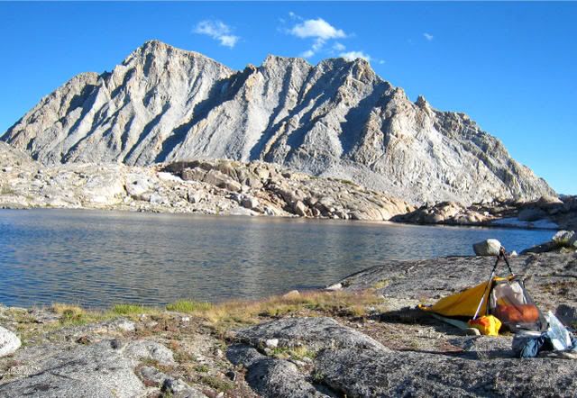
Day 3: The other fellow and I leapfrogged each other all day! I took the easier Class 1 Royce Pass and he took �Pass 11,840� and we stumbled upon each other at Granite Basin, both of us patiently waiting for the right lighting for stunning photographs. A barely discernable trail ascends to Italy Pass, from where I traversed high in the mile of talus to Dancing Bear Pass and he traversed lower. There he was again on the pass. We finally traded e-mail addresses and parted ways! The beautiful Bear Lakes-Seven Gables Basin contains another 16 named lakes and many ponds. I slowly meandered by five on my way to camp at the outlet of Vee Lake, running into several Ptarmigans, one other fellow and spotted one tent in the distance. The weather cleared and the wind subsided, unfortunately allowing mosquitoes to be pesky. Otherwise, it was a very fine day.
Granite Basin
White Bear Lake from Dancing Bear Pass
Big Bear Lake
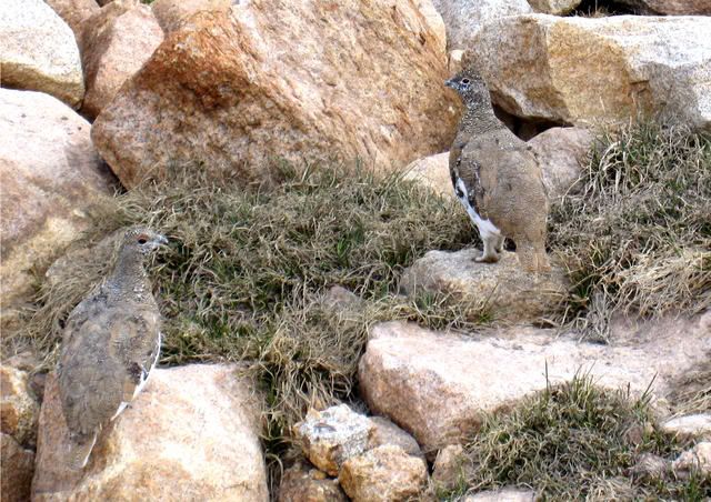
Ptarmigans
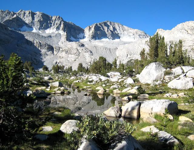
Day 4: There is a poor use-trail from Seven Gables Lakes to the PCT. Even though I had been down this use-trail before, I missed it in several spots. Where the trail starts on the 7.5-minute topo map, I crossed the river (south) and contoured directly to the basin above Sandpiper Lake, primarily following good game trails. This beautiful basin, barely a mile off the PCT, contains over a dozen lakes, many with musical names, like �Flat Note Lake� and �Sharp Note Lake�. I slowly wandered through the lakes and found a nice campsite at Three Island Lake, with a great view of the west side of Seven Gables Peak. I had come 7 miles in 7 hours that included a lot of �stop and photograph time. I spent the night worrying about my route for the next day.
Sunset Seven Gables
Three Island Lake Camp
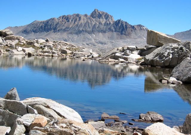
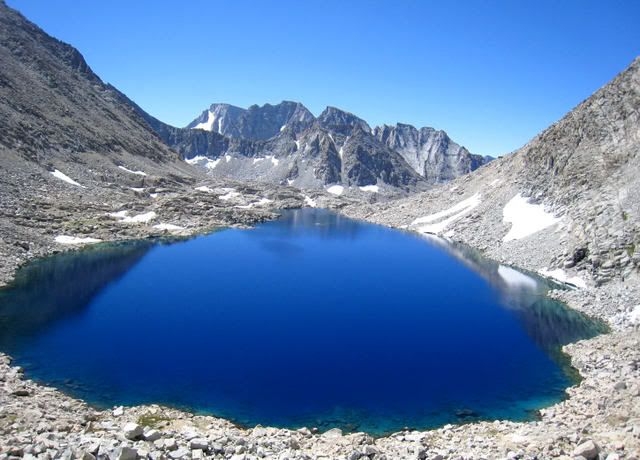
Day 5: There is no pass as such leading to West Pinnacle Creek. I steadily climbed an easy, grassy, upward ramp to a notch dropping into Sanger Creek. From the notch I climbed up some pretty difficult slabs and over the top of a rounded mountain to a set of beautiful small lakes, perched up high, called the Turret Lakes, where I again ran into Ptarmigans who did not appear to be concerned about me in the least! After a lunch break, I descended an easy gully to Old Squaw Lake. West Pinnacle Creek contains 8 named lakes and numerous unnamed ponds. I think I visited every one on my quest to finally settle into a campsite at Big Chief Lake! Another 7 miles and 7 hours! I spotted big golden trout in Spearpoint Lake. I again worried about my route. My plan was to traverse to East Pinnacle Creek and descend directly to Piute Canyon. If this did not work, I would be up a creek, so to speak, with nowhere to go and running out of food!
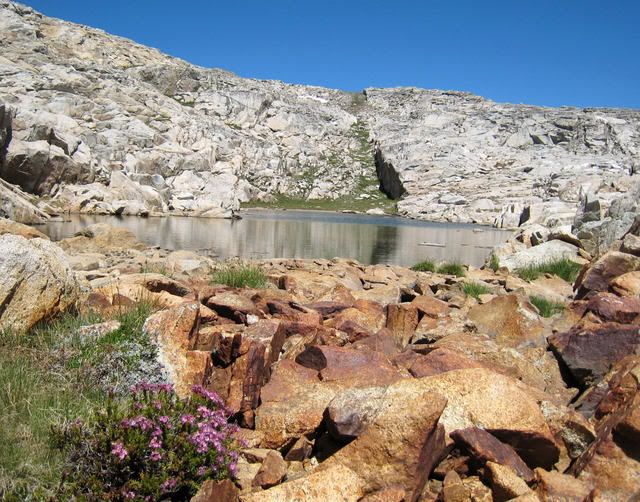
Turret Lake
Big Cheif Lake Camp
Day 6: The traverse to East Pinnacle Creek was much harder than I had anticipated, with VERY trick route-finding. But, the view down the slope to the canyon was a big relief- there were plenty of good, easy routes to descend. My current problem was to keep traversing the series of benches and small cliffs, having to backtrack several times. I decided to just keep on my pack as I looped through the 8 lakes of the upper basin, just in case I wanted to camp there. I stuck to my original plan to camp at Big Moccasin Lake, at the very edge of the bench. What a view! Although I only traveled about 5 miles, it took me over 6 hours. I had not seen a single person in the last few days.
The Pinnacles from East Pinnacle Creek
Little Moccasin Lake (below Big Moccasin Lake)
Day 7: I descended to Piute Canyon in short order, where immediately, I ran into 7 groups of people on the 2 miles of trail that I traveled before cutting off-trail to Honeymoon Lake. Although there is a trail to the lake marked on the 7.5-minute topo map, I never found it. Now I would traverse high past Lobe Lakes to Packsaddle Lake. A big route-finding error (corner of 4 maps!) created much more difficult than needed as I took the wrong gully to a set of small ponds, instead of Lobe Lakes. The traverse to Packsaddle Lake was also tricky. The joint system in the rock kept veering me where I did not want to go! The first thing I did when I finally reached the lake was jump in! I had the entire basin to myself. I did not have the energy to climb the several hundred feet over talus to see Paine Lake.
Packsaddle Lake
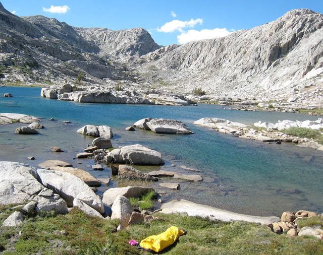
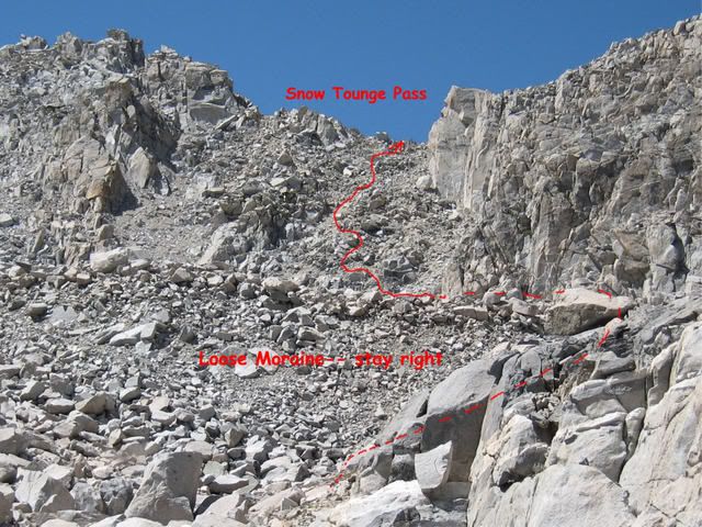
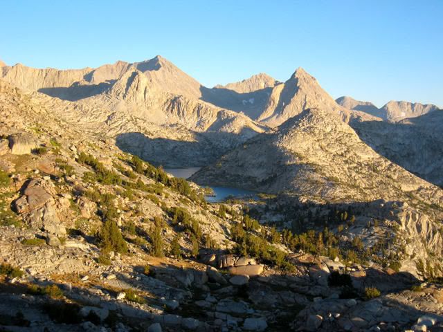
Day 8: This day, I again contoured at timberline ending up at the Golden Lakes. My route intersected the trail for brief moment. Predictably, there were people! Off to Wahoo Lakes, nobody followed me, and for a good reason. You better like talus-hopping if you go to Wahoo Lakes. Now I had to make a decision. My original plan was to traverse over to Goethe Lake and then just go out the Piute Pass trail. I was a day ahead of schedule and backtracking over that talus was not too appealing. Although I would not be were I was supposed to be, I decided to go over Snow Tongue Pass (part of Roper�s High Route) and go out to North lake via Lamark Col. The pass was short � only 30-minutes of exposure to steep, loose, scary stuff, but not quite the horror stories that I had read on the internet. Thank goodness for a light pack. The south side was easy and now I traversed several miles of delightful grassy benches full of bright blue lupine and drop-dead views of Evolution Basin below. My only trouble was getting off the bench! I vaguely recalled Roper warning of this. There is little water on the bench, so I was getting a bit anxious. I ended up going all the way to the upper Darwin Lakes (instead of my plan to camp on Darwin Bench). The view of Mt. Darwin was fantastic.
View of Mt. Humphreys from upper Wahoo Lake
Ugly Pass
Camp at upper Darwin Lakes
Day 9: I packed up and stashed my gear and took a day-hike up to Alpine Col. I was curious, since there was also much comment on the internet regarding this pass. It WAS much worse than Snow Tongue Pass, but what a view! I peeked over the top to Goethe Lake (not as pretty as it looked on the topo map) and went back, picked up my pack, and moved camp to the far end of Darwin Bench, dotted with lakes, where I camped perched on the very edge of Evolution Canyon. Several people passed on the trail far below.
Upper Lake- below Alpine Col
Sunset on Evolution Basin from Darwin Bench Camp
Day 10: I had been over Lamark Col many years earlier. I was really surprised at how the use-trail had now become quite large. A string of large lakes are followed as the �trail� stays on the north shoreline, at times literally climbing over rocks above the water. I met two groups of climbers. What happened, I do not know, but I ended up on the wrong pass! Thank goodness I knew when I looked over the top that I was in the wrong place. A quick traverse north brought me to the proper pass! The east side is so different now. It used to be all snow; now it is an ugly mixture of ice, sand, and talus. I chatted with an Australian couple on the other side before descending the large, easy-to-follow trail that used to be just a faint path. Although I easily could have made it out to North Lake, I camped at Lower Lamark Lake. This has to be the most �fishy� smelling lake I have ever been to. Stopping short of the final 1,000 feet of descent saved my old knees as well as a $20 campground fee.
[img]
http://i249.photobucket.com/albums/gg233/npallister/Pohono/NLk08_175A_Flowers_Darwin_Bench.jpg[/img]
Flowers on Darwin Bench
[img]
http://i249.photobucket.com/albums/gg233/npallister/Pohono/NLk08_182A_View_LamarkCol.jpg[/img]
View from Lamark Col
Day 11: I was up early and quickly descended. I was grateful that my car started and headed home, not even stopping in Bishop, however, I could not resist Jolly-Kone in Bridgeport. Ice cream is my weakness. My route, as completed, was 75 miles, 19,000 feet of elevation gain, 62 percent of travel off-trail. As usual, I just about was right on a travel rate of 1 mph. I had purposely gone slowly through much of this route to enjoy the lakes and photograph.


 Previous Topic
 Index
Index


