Posted by: kevonionia
Curiosity Creek - 11/03/11 08:13 PM
On a hike last month in the San Juans, I came upon a little side creek flowing into Bear Creek that startled me and got my curiosity up so much that I took some pix and even asked the two college-aged girls having lunch nearby if they knew what was up (having learned that on many a trail, those who are half my age often know twice as much.) They, too, were mystified.
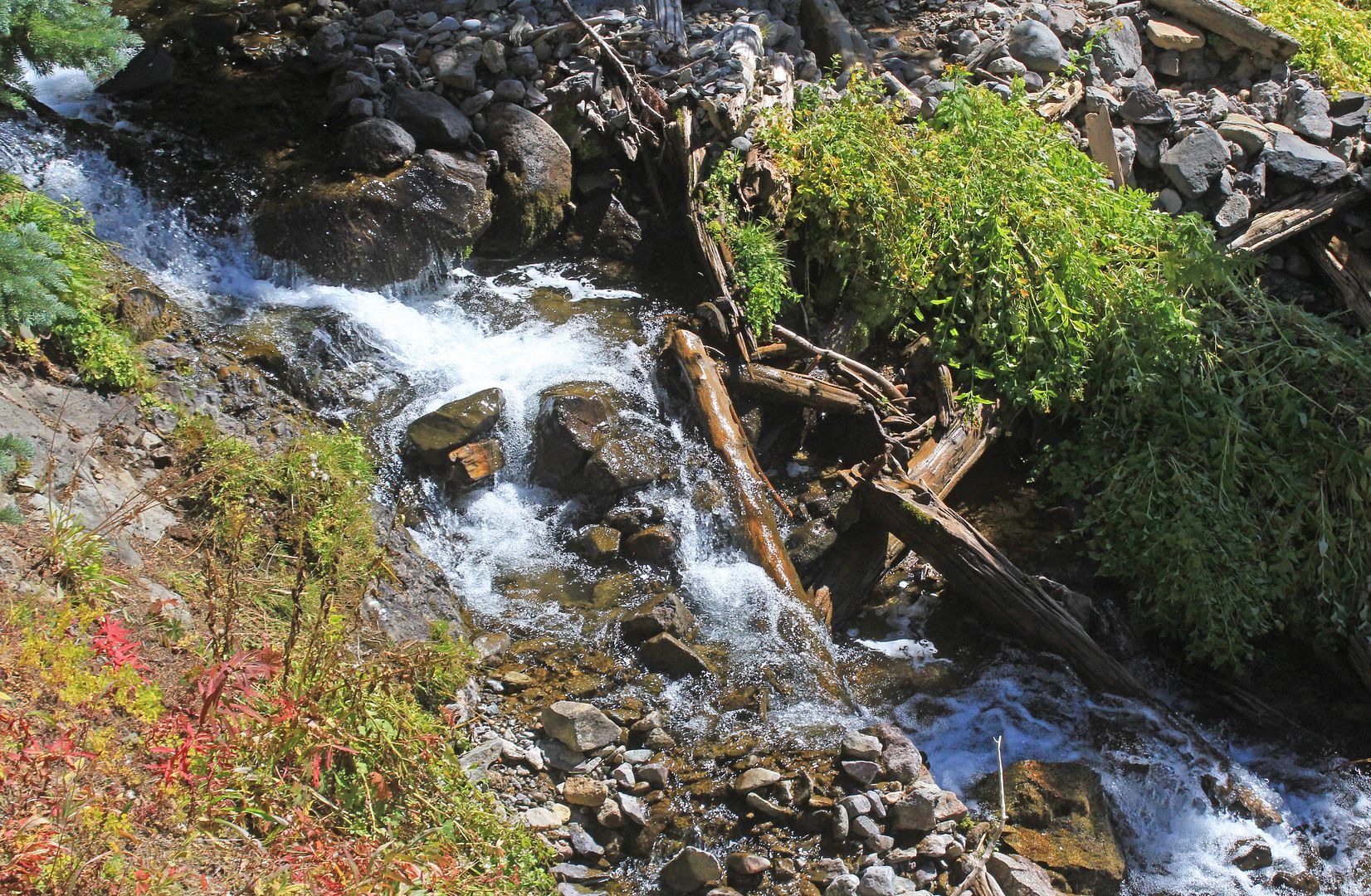
The two creeks met near the Yellow Jacket Mine, the turn-around point of my hike. Bear Creek above the fork was clear as a bell:
But where they joined, the smaller creek, labeled South Fork (of Bear Creek) on my map that came down from Engineer Pass, had the riverstones covered in a white film or crust:
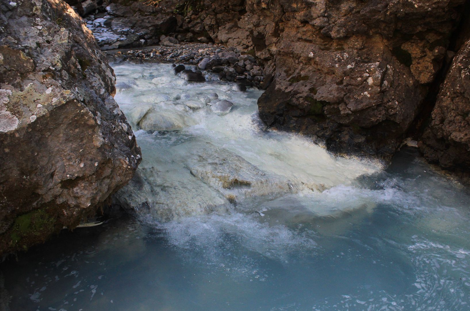
At the pool where they met, the water had a milky quality to it that reminded me of the glacial or rock flour creeks seen in the high streams in the Canadian Rockies. I'd never really seen anything like it before in Colorado; the streams I've seen here are all pretty much crystal clear. The area was littered with mines, but this wasn't the red-tainted tailings water I had seen up by Ironton and Red Mountain Pass.
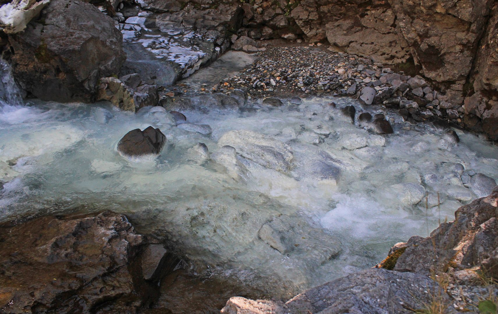
The milky quality went away less than a hundred yards from the meeting point of the two creeks.
Any ideas on what causes this:
(I'm hoping that the answer's not so simple someone's 5th-grader responds or I'll be taking advice from someone 1/5 my age.)
.
The two creeks met near the Yellow Jacket Mine, the turn-around point of my hike. Bear Creek above the fork was clear as a bell:
But where they joined, the smaller creek, labeled South Fork (of Bear Creek) on my map that came down from Engineer Pass, had the riverstones covered in a white film or crust:
At the pool where they met, the water had a milky quality to it that reminded me of the glacial or rock flour creeks seen in the high streams in the Canadian Rockies. I'd never really seen anything like it before in Colorado; the streams I've seen here are all pretty much crystal clear. The area was littered with mines, but this wasn't the red-tainted tailings water I had seen up by Ironton and Red Mountain Pass.
The milky quality went away less than a hundred yards from the meeting point of the two creeks.
Any ideas on what causes this:
(I'm hoping that the answer's not so simple someone's 5th-grader responds or I'll be taking advice from someone 1/5 my age.)
.