Looking for some trip ideas for this winter... I live in Sacramento and looking for trips within a 1 to 5 hour drive of home.
The Lost Coast is for sure on the list, but would like to find some other options, maybe even in the Sierra foothills.
Unfortunately, right now I've got down to a 20 degree bag. Not looking to do any snow camping.
Any suggestions are appreciated no matter how long, short, or epic. Cross country routes would be fun too, but realizing it's winter and that limits a lot of things.
Point Reyes National Seashore - very civilized but beautiful. There are enough trails to do a substantial 3-4 day trip although it would involve lots of looping around.
Henry Coe State Park - once the rains start - water is a problem in early winter before rains. This state park always amazes me. It has some serious backpacking and is huge. I have done 5 day trips of more than 60 miles. You need to get a map put out by the park- USGS topos are useless there. You can find a lot of maps on the internet.
Feather Falls - overnight backpack staying above the falls.
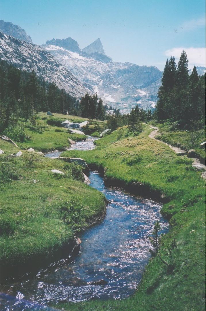
Yosemite- lower elevation trails from the Valley if you are willing to do a bit of snowshoeing.
There are year-round trails in Trinity Alps (western section of the wilderness area) as well as Marble Mountains.
And there is an unofficial "coastal trail" - google "coast walk" and there is information. There are also two guidebooks-one covers Oregon border to Monterey, the other Monterey south. There are a lot of mostly trail sections, with a little bit of road walking.
I have also done a 2 day backpack in Marin Headlands- Mt Tamapias.
I have not done it- but what about Lasson Park? You would have to have snowshoes, but there are plenty of time periods where it does not get below 20 degrees.
There is stuff down by Big Sur - but others would have to chime in on these. I know little about this area.
Forgot to add - the river canyons. Trails up the Yuba. I used to do 2-3 day trips dropping down to the NF American River from Foresthill Divide - but a fire burned some of the trails and it can get very challenging. The horse riders used to keep the trail clear, but now with all the deadfall, no horses, no trail maintained. Pretty gnarly down there right now. You can still go down to Mumford Bar, or Italian Bar. You have to ski or snowshoe the road from the winter parking area (snowmobiles so a bit annoying until you drop down). I have stashed snowshoes once out of the snow. Also - what about the lower end of the Western States Trail? I believe that some of the Western States trial may have been affected by fire this summer. Another possibility- snowshoe down the road (off Hwy 88)to Salt Springs Reservoir. There is a year-round road (very muddy 4wd) that you could also take. You would have to call Forest Service about that road. I believe it is a 10-mile round trip backpack from the dam to the upper end of the Reservoir.
Keep watching the weather. It might be you'll be able to hike anywhere all winter, given we're in a drought. (Two years ago Tioga Pass opened in midwinter and folks ice-skated up there.)
The thing is, you don't need a lot of snow to get it below 20F. Right now there is 10 - 18F in the forecast as low as Yosemite valley - it's forecasted to be 32F right here at 500 feet elevation, in the Central Valley in town. Having a good base layer, a couple mid layers and a jacket plus a good warm balaclava and good eating/hydration habits will go a long way to getting you warm and safe at those temps....
You are going to be limited to the coastal areas if you don't want snow - and even then you can expect a few inches. One spring I was caught in a white out at 3,000 feet on a ridge just a few miles from the ocean. Not entirely unworkable, but it led to using my umbrella (brought for sun) as a way of keeping snow off my cheeks. It was blowing sideways.
In the Big Sur, the singular resource for backpackers is ventanawild.org - that area has trails that disappear in a single storm. Right now there is a comprehensive fire ban in place - no smoking, no stoves, no fires, not a single spark allowed in the wilderness anywhere in the Los Padres NF. On the up side, no bear cans needed, and no permits for backpacking - avoid Sykes Hot Springs and you might just not see a soul (I saw two hunters last weekend when out there). Have good navigation skills and read up on the trip reports on the aforementioned website, and from that site, visit Jack Glendening's trail map, which is a much more accurate map than any published ones - Jack is on the trail crew and pretty much lives out there. His GPS tracks are accurate and can save your bacon if you are wandering and the trail turns into a multitude of game trails and use trails. The signs are mostly gone out there. I uploaded the map to my GPS and didn't bring a paper map - which runs counter to my usual habit, I'll tell you, but the paper maps, particularly the Wilderness Press version, are often completely wrong and show trails that no longer exist due to the fire that burnt up 75% of the wilderness.
Point Reyes is an awesome and much tamer experience. Henry Coe is some wild stuff - check with the park about water before you go. We were out there when the national parks shut down - the main creek was dry, and we cowboy camped in the stream bed. Water can be a challenge if it hasn't rained enough. A few of the springs are reliable, but the list on the website is old - ask the rangers.
The Lost Coast will require you to have a bear canister. Point Reyes has raccoon boxes. Coe we usually hang food to keep rodents out.
_________________________
"In the beginner's mind there are many possibilities. In the expert's mind there are few." Shunryu Suzuki
Registered: 04/29/07
Posts: 205
Loc: Berkeley, California
I second or third Henry Coe. I call it my spring home ( as summer is too hot and dry during drought years). Even in Winter you need to check water source conditions. Their website has a page on that. Close to headquarters there ate cushy backpacking campsites, including nice portalets. Further there are wilderness acres upon acres and two other entrances with wilderness. I don't fish but i understand the fishing there is really good.
Without really adding anything very new to the subject, I am partial to the Ventana/Big Sur area (and the Silver Peak Wilderness just to the south). I would recommend doing the high open ridge hikes over the deep shaded canyons though: man alive is it cold, damp, and dark down in the bottom of a redwood canyon in winter, IMHO. My favorite trail for winter there is out of Bottcher's Gap back to Pat Springs. I have a wonderful memory of a warm trip there under a full moon in a drought year in February on that trail...Of course I recall Lori writing here of a trip she did there that involved a whiteout! NOAA is definitely one of my favorite resources in winter! Henry Coe IS very nice, I love it, but my one complaint is that they don't allow fires in the backcountry (it's a CA state park), which is fine in spring, but in winter I really prefer a fire. By the way,some of the CA state park backpacking trails in the Bay Area are closed down in the off season. For sure, Big Basin, Portola, and Butano are closed Nov 1 until Apr 30, which is really really lame: April is the best time to be there (grumble, grumble) I don't know about State Parks elsewhere. Coe is open, so is Castle Rock, and I think Austin Creek is. Pescadero Creek is a San Mateo County park with backpacking and it's open year round. I love that place, but it is very shady. Another trip, which I've never done but want to some day, is the Ohlone Trail from Del Valle to Sunol, right in the Bay Area. It has a big waterfall which really only flows in the rainy season. I believe it's a 31 mile thru-hike, with a big elevation gain.
Oh, and the Ohlone trail grades will give Coe a run for its money - the Big Burn is pretty #$^@~ steep, and when it's muddy, you are lucky if you don't glissade down it!
You need trail camp reservations in advance, and you need an Ohlone permit - two bucks, good for a year - and you need to figure out how to get campsites that let you do the daily miles you want to do. Parking on the Mission Peak end of the trail is dicey; cars get broken into, and there's no shuttle to either end to the other, so knowing someone who can pick you up at Del Valle (safer parking there) and drop you at the Fremont end is helpful.
Ohlone is prettiest in spring, when it's green. Saw a golden eagle in Sunol! Look out for cows and don't forget the water filter.
_________________________
"In the beginner's mind there are many possibilities. In the expert's mind there are few." Shunryu Suzuki
Our long-time Sponsor, BackcountryGear.com - The leading source for ultralite/lightweight outdoor gear:
Affiliate Disclaimer: This forum is an affiliate of BackcountryGear.com, Amazon.com, R.E.I. and others. The product links herein are linked to their sites. If you follow these links to make a purchase, we may get a small commission. This is our only source of support for these forums. Thanks.!


 Previous Topic
 Index
Index


