These days, just about every backpacking discussion group includes people warning about the dangers of relying exclusively on GPS units for navigation. We know, because we’re often the ones who are issuing the warnings. We’re big believers in knowing where you are, and how to get where you are going without depending exclusively on any battery powered device. And a GPS unit won’t always show you the terrain you might need to cross. Coming down the face of El Capitan to get to Yosemite Valley isn’t an option for most people…even though a GPS unit shows you that it’s only a about 1/4 mile.
And it seems that every few weeks we read a news story about someone who follows their GPS blindly into increasingly primitive roads and conditions…and has to be rescued. So don’t put all your faith in your GPS.
But a couple of recent experiences have us taking a bit of the same approach to the old school standby of printed maps and compass. Because it turns out they can lead you astray as well...
We’ve noted some problems with some of the National Geographic maps. Red Can Lake in the Emigrant Wilderness is called Red Canyon Lake on their map. And another section of trail in Yosemite that was marked at 6 tenths of a mile turned out to be less than 150 yards. So maps are fallible.
How fallible?
Driving back from our trip to the Ansel Adams Wilderness, we were stuck in a massive traffic jam on Labor Day Monday on highway 41 in the town of Coarsegold. No worries, because we quickly pulled out two different printed maps (AAA and DeLorme) and found a series of side roads that would circumvent the problem. And we love exploring like this.
So we quickly turned off towards the town of Raymond, and followed the maps through town and towards LeGrand. The roads were nicely paved, empty, and we felt pretty darn clever about the whole thing.
Until we got to the junction that led north to Mariposa. We didn’t turn right, because that would take us miles out of our way. But the only other option was straight ahead: a primitive dirt road heading off into the wilderness. Both of our maps showed it as paved. Maybe the dirt part was only a mile or two.
Nope.
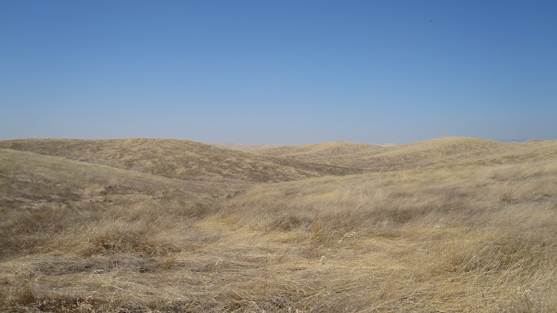
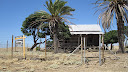
For the next twelve miles or so we drove on one of the most isolated roads we have ever seen in California—miles and miles of unfenced, untouched grassland. An ocean of foothills, and not another vehicle in sight. Although we did find a sign for some property for sale…
In the end, we finally came out the other side, covered in dust, and continued on our way into LeGrand and beyond. Yeah, we were delayed by the slow going on the dirt road, but not much more than if we had stayed in the traffic jam.
When we got home, we checked Google maps, which shows the route as a very primitive dirt road. So at least their maps are more accurate than the other two.
And we’re just grateful that we didn’t have to hike out of there somehow because our car broke down.
You would have heard about it on the news, of course.


 Previous Topic
 Index
Index


