#186711 - 08/22/1409:41 AMNavigating With a Button or Other Simple Compass
4evrplan
member
Registered: 01/16/13
Posts: 913
Loc: Nacogdoches, TX, USA
I've found lots of information online about navigating with an orienteering compass, but has anyone found any good articles about navigating with a very simple compass (no baseplate or bezel)?
_________________________
The journey is more important than the destination.
Well, the equivalent question for a surgeon is "Are there any articles on doing surgery with a butter knife?"
With a cheap compass, you will get cheap results. This may be enough depending on your goals.
One way to learn to use a compass is with a series of exercises which you can do near home. If I were to teach you, I'd have you draw maps using the compass and pacing.
I really got into this about 3 years ago, and now I can navigate compass only with an accuracy of about 50 feet per mile. I'd test myself by hiding an Altoid can with $10 in it a mile away from the start. A couple days later, I'd take a different route back to it and retrieve the can. I used to do these exercises in the desert.
This is a good book. I could also start you out with some exercises to accomplish the same thing.
Happen to have trekking poles with tiny button compasses in the handles. They're useful for keeping general track of north when in the woods and on cloudy days, which can then facilitate keeping the map oriented correctly. But for actual navigation involving triangulation with landmarks, they're not going to cut it.
It definitely helps to know your magnetic declanation, so you can compensate while using one.
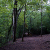
It depends a lot on where you are. Where I do most of my hiking here in Michigan in the woods it is unusual to be able to walk in a straight line for 100 ft or even to be able to see something more than 200 feet away if you are off trail. Usually I am aiming for some type of linear feature like a road or a stream. Usually at some point you will come to a place where you can get a longer view or known feature and reorient yourself. Even on the trails they wander way too much to be able to actually follow a heading. I have frequently followed a trail and found myself heading in a far different direction than what I thought I was heading. After a few dozen +/- 30� direction changes you are easily confused. I frequently use my watch as a compass to maintain a general sense of direction. The times when I have been in areas where I can see something a long ways away it is an interesting experience for me.
#186718 - 08/22/1403:44 PMRe: Navigating With a Button or Other Simple Compass
[Re: Gershon]
4evrplan
member
Registered: 01/16/13
Posts: 913
Loc: Nacogdoches, TX, USA
To elaborate, I have no interest in orienteering competitions or even going off trail at this point (maybe sometime in the future). For now, I'm more interested in making sure I'm on the correct trail, as marked on a map, in a small(ish) wilderness area. I'm planning to take my first overnight hike in the Caney Creek area (thank you for the suggestion Slowfoot) at some point in the fall, and the description on Ouachitamaps.com says there's a few side trails that aren't on the map, even a place or two where the main trail appears to go straight but really turns.
Plus, the first two items on the ten essentials list are a map and compass. If I'm going to carry them, I should have at least a preliminary understanding of how to use them. I'm not completely clueless. I know my compass points and can navigate a car using a road map, and I've found a few geocaches (GPS assisted), but I thought I should know the basics about wilderness navigating just to make sure I'm on the right trail. But, all of the articles about navigating assume you have a nice compass, and I was hoping to use what I have, if I can make it work.
_________________________
The journey is more important than the destination.
In my opinion, if a person starts learning how to navigate with a compass and has a map in front of them, they will never really learn how to use a compass.
This is what I call the QuickNav test.
The goal is to navigate to a bearing and a distance about a half mile away and back to the starting point without using a map. Navigate back by a different route than the one taken out.
The SNOT (Simply Navigate Off Trails) candidate will log a bearing and a distance each after hundred feet of travel. They will draw the map as they move. When they draw the map, they will estimate the direction for each arrow. No fair using a protractor. The error will be the difference between where the map shows they are at the end and the starting point.
This test should be done in a wooded area without bad underbrush. It should be safely bounded by roads or other features so the candidate can't get lost.
Passing score is the map shows the candidate within 200 feet of the starting point when they return to the starting point. An accurately drawn map must end within 50 feet of the starting point.
If using a compass to navigate, it is a simple problem of summing vectors. Connect each vector to the head of the vector behind it, and you have a map. A vector is a bearing and a distance. I always use 100 feet because it's easy. It's also SLOW.
These are the results of one of my tests while bushwhacking in a wooded area without bad underbrush. I was right at 200 feet with my estimated map. My accurate map drawn with carefully drawn vectors was only 24 feet off after almost 5,000 feet of travel.
A person can stay oriented pretty well if they draw the map as they travel off trail. Whether this is necessary or not depends on the situation.
To elaborate, I have no interest in orienteering competitions or even going off trail at this point (maybe sometime in the future). For now, I'm more interested in making sure I'm on the correct trail, as marked on a map, in a small(ish) wilderness area. I'm planning to take my first overnight hike in the Caney Creek area (thank you for the suggestion Slowfoot) at some point in the fall, and the description on Ouachitamaps.com says there's a few side trails that aren't on the map, even a place or two where the main trail appears to go straight but really turns.
Plus, the first two items on the ten essentials list are a map and compass. If I'm going to carry them, I should have at least a preliminary understanding of how to use them. I'm not completely clueless. I know my compass points and can navigate a car using a road map, and I've found a few geocaches (GPS assisted), but I thought I should know the basics about wilderness navigating just to make sure I'm on the right trail. But, all of the articles about navigating assume you have a nice compass, and I was hoping to use what I have, if I can make it work.
Changed.
If you tell us which trail you are hiking, I can show you how to get a free map optimized for navigation. Any example trail will do if you haven't decided yet. All I'll need is the starting location so I can find the map.
#186736 - 08/22/1410:36 PMRe: Navigating With a Button or Other Simple Compass
[Re: 4evrplan]
billstephenson Moderator
Registered: 02/07/07
Posts: 3917
Loc: Ozark Mountains in SW Missouri
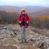
That's some really cool looking terrain.
It looks like on this map that it's about a 9-10 mile loop. I doubt you'll have much trouble there.
I wouldn't expect many trails not shown on your map. You might see some game trails and few lessor used spur trails, but the main trails and forks in them should be pretty easy to know.
When you're down on the creek trail there you really can't get lost. If I did this trip I'd probably start with the creek trail and take the Buckeye Trail out, but I'd be very tempted to do an out and back along the creek. I'd have to decide once I was there. That looks like it might be pretty darn nice down in there and if it was I might have to hang out there as long as I could get away with it, and I wouldn't feel bad about it either.
Keep in mind, I overkill map preparation and compass use. I'll try to present it in a way that's easy enough to follow. This might take a couple weeks. Most people follow trails without using a compass, so if you aren't interested, let me know. I've never seen anyone but me take out a compass on the trail. I only use a compass myself when I feel like practicing compass navigation.
While you are waiting for your map, you can learn how to prepare a map so you can do it quickly when you get it.
First, let's talk about compasses. If all you are looking for is to make sure you don't go south instead of north, then a button compass is fine. The next step up is an inexpensive compass with the degrees marked on the outer ring. These can often take a long time for the needle to settle down. The next step up has a rectangular base plate with some measurements on the side. To determine your magnetic heading, you have to face the direction of the trail and rotate a dial so the north side of the needle is under a north arrow.
An inexpensive Brunton compass will work. You can usually find them under 10 dollars in the box stores.
The next step is a compass with a rotating dial. This eliminates most sighting errors because you don't have to remember to put the north part of the needle over the north arrow.
All of these compasses have sighting errors. Even if the compass is accurate, most people will have an error of 5 to 10 degrees with this type of compass.
A compass without some sort of rectangular baseplate is almost useless for planning a hike, so I recommend you at least get that.
The best compasses are lensatic compasses or mirror compasses. I'm only familiar with the lensatic compasses. The Cammenga 27 is a military compass and will last a lifetime with reasonable care. It uses some sort of magnetic dampening for the dial. It will work even if not completely level. You can get them from Amazon for $39.99. This is the only type compass of the ones I've mentioned that is suitable for triangulation from distant points. You can get Chinese imitations for about $10 to $15. These are lower quality and eventually the dial will start to stick.
The lensatic compasses are great for people who wear glasses. The lens will compensate for eye problems depending on where you put your eye relative to the lens.
Since you mentioned you don't want to spend too much money on a compass, I'd recommend something with a rectangular baseplate. I'll be using a Brunton type 7 compass for the examples. You should be able to get a similar compass for around $10.
Let me know when you get a compass, and then I can go to the next post.
Oh, one last thing. Make sure your belt buckle doesn't affect the compass. Same thing with the cell phone and anything else you carry in your pockets.
#186743 - 08/23/1410:29 AMRe: Navigating With a Button or Other Simple Compass
[Re: billstephenson]
4evrplan
member
Registered: 01/16/13
Posts: 913
Loc: Nacogdoches, TX, USA
Originally Posted By billstephenson
That's some really cool looking terrain.
It looks like on this map that it's about a 9-10 mile loop. I doubt you'll have much trouble there.
I wouldn't expect many trails not shown on your map. You might see some game trails and few lessor used spur trails, but the main trails and forks in them should be pretty easy to know.
When you're down on the creek trail there you really can't get lost. If I did this trip I'd probably start with the creek trail and take the Buckeye Trail out, but I'd be very tempted to do an out and back along the creek. I'd have to decide once I was there. That looks like it might be pretty darn nice down in there and if it was I might have to hang out there as long as I could get away with it, and I wouldn't feel bad about it either.
I thought it looked really nice too, but, I was thinking of hiking it in the opposite order. I will have a couple of nine year olds with me and one other adult (also a newbie), so I thought we'd better take the more strenuous hike the first day while we're still fresh and take the easier hike along the creek the next day. We'll be getting there late, parking at the southern trail head, the eastern end of Caney Creek Trail and setting up as close to the cars as we can find a spot. In the morning, we'll go back past the cars, up the road to Buckeye Trail and take it west all the way to where it meets Caney Creek Trail. Just west of the trail junction is the campsite for the night. The day after that, it's a straight shot east along the creek, back to the car.
_________________________
The journey is more important than the destination.
#186744 - 08/23/1410:37 AMRe: Navigating With a Button or Other Simple Compass
[Re: Gershon]
4evrplan
member
Registered: 01/16/13
Posts: 913
Loc: Nacogdoches, TX, USA
Originally Posted By Gershon
That was the only map I could find, too.
Keep in mind, I overkill map preparation and compass use. I'll try to present it in a way that's easy enough to follow. This might take a couple weeks. Most people follow trails without using a compass, so if you aren't interested, let me know. I've never seen anyone but me take out a compass on the trail. I only use a compass myself when I feel like practicing compass navigation.
While you are waiting for your map, you can learn how to prepare a map so you can do it quickly when you get it.
First, let's talk about compasses. If all you are looking for is to make sure you don't go south instead of north, then a button compass is fine. The next step up is an inexpensive compass with the degrees marked on the outer ring. These can often take a long time for the needle to settle down. The next step up has a rectangular base plate with some measurements on the side. To determine your magnetic heading, you have to face the direction of the trail and rotate a dial so the north side of the needle is under a north arrow.
An inexpensive Brunton compass will work. You can usually find them under 10 dollars in the box stores.
The next step is a compass with a rotating dial. This eliminates most sighting errors because you don't have to remember to put the north part of the needle over the north arrow.
All of these compasses have sighting errors. Even if the compass is accurate, most people will have an error of 5 to 10 degrees with this type of compass.
A compass without some sort of rectangular baseplate is almost useless for planning a hike, so I recommend you at least get that.
The best compasses are lensatic compasses or mirror compasses. I'm only familiar with the lensatic compasses. The Cammenga 27 is a military compass and will last a lifetime with reasonable care. It uses some sort of magnetic dampening for the dial. It will work even if not completely level. You can get them from Amazon for $39.99. This is the only type compass of the ones I've mentioned that is suitable for triangulation from distant points. You can get Chinese imitations for about $10 to $15. These are lower quality and eventually the dial will start to stick.
The lensatic compasses are great for people who wear glasses. The lens will compensate for eye problems depending on where you put your eye relative to the lens.
Since you mentioned you don't want to spend too much money on a compass, I'd recommend something with a rectangular baseplate. I'll be using a Brunton type 7 compass for the examples. You should be able to get a similar compass for around $10.
Let me know when you get a compass, and then I can go to the next post.
Oh, one last thing. Make sure your belt buckle doesn't affect the compass. Same thing with the cell phone and anything else you carry in your pockets.
Gershon, I can tell you take this very seriously. If there's ever a zombie apocalypse, I want you to be part of my group. However, if you guy's are confident a button compass, or even no compass at all, is sufficient for my planned hike, getting something better isn't a priority right now. I'd much rather sink that money into a Sawyer Mini or something. Having said that, thank you for your generous offer to step me through all of this, and if/when I get back to it, I'll let you know.
_________________________
The journey is more important than the destination.
#186745 - 08/23/1411:02 AMRe: Navigating With a Button or Other Simple Compass
[Re: 4evrplan]
billstephenson Moderator
Registered: 02/07/07
Posts: 3917
Loc: Ozark Mountains in SW Missouri
Quote:
I thought it looked really nice too, but, I was thinking of hiking it in the opposite order.
The main reason I'd take the creek trail in is because that 1st left turn off the gravel road onto the Buckeye trail is really the only tricky part you're likely to encounter going that way. If that trailhead is well marked you'll be fine, if not it could be very easy to miss. Not that you'd get lost by breezing by it, you'd know soon enough for sure, but you can't make that mistake coming out. You could of course breeze by the Buckeye trailhead on the creek too, but the scenery would probably be more fun if you did
I have a button compass that I wear on my watchband. Same compass and setup I used when I was diving. I am familiar with mapping and navigation with both the lensatic and the baseplate compasses, and have made several rough maps. It's a skill I'm always glad to have in my back pocket, and sometimes use the principles just in my head to work out what is going on.
But in actual practice, I really only use the compass to orient my map. If I need to do it and worry about declination, I have degrees marked on the rim.
But let me second something above. For careful use, I have to get the compass away from my watch. The watch throws the compass off about six degrees.
Talk about confusing. Most of the diving I did was commercial. That meant that one was lucky if you could see your hand when it was pressed up against your face plate. When I got the compass where I could see it, there were the tanks, my instruments, my regulator and the metal ring on the faceplate all close enough to deflect the needle. On top of that was whatever we were inspecting; rebar in a bridge piling, the ship whose bottom we were inspecting, etc. We tried that only a couple times and then went back to the classic technique of using marker bouys (then we only had to measure and allow for the current). Best, jcp
#186793 - 08/25/1401:49 PMRe: Navigating With a Button or Other Simple Compass
[Re: 4evrplan]
Slowfoot
member
Registered: 04/22/05
Posts: 159
Loc: Missouri
I've hiked the same loop the same way you plan to. The trailheads are well-marked and there are signs at both. There were a couple spots where we weren't sure which way to go, where the trail was not obvious or there was an intersection not on the map, but we figured it out and eventually found trail markers to confirm. If you know approximately where you are on the map, you can usually figure out which way the trail goes. A button compass is fine almost all the time in Arkansas. You can't do much triangulation anyway and the declination is close to 0.
#186795 - 08/25/1402:30 PMRe: Navigating With a Button or Other Simple Compass
[Re: Slowfoot]
4evrplan
member
Registered: 01/16/13
Posts: 913
Loc: Nacogdoches, TX, USA
Originally Posted By Slowfoot
I've hiked the same loop the same way you plan to. The trailheads are well-marked and there are signs at both. There were a couple spots where we weren't sure which way to go, where the trail was not obvious or there was an intersection not on the map, but we figured it out and eventually found trail markers to confirm. If you know approximately where you are on the map, you can usually figure out which way the trail goes. A button compass is fine almost all the time in Arkansas. You can't do much triangulation anyway and the declination is close to 0.
Fantastic! Thank you so much Slowfoot! I'm really looking forward to this hike.
_________________________
The journey is more important than the destination.
Our long-time Sponsor, BackcountryGear.com - The leading source for ultralite/lightweight outdoor gear:
Affiliate Disclaimer: This forum is an affiliate of BackcountryGear.com, Amazon.com, R.E.I. and others. The product links herein are linked to their sites. If you follow these links to make a purchase, we may get a small commission. This is our only source of support for these forums. Thanks.!


 Previous Topic
 Index
Index


